

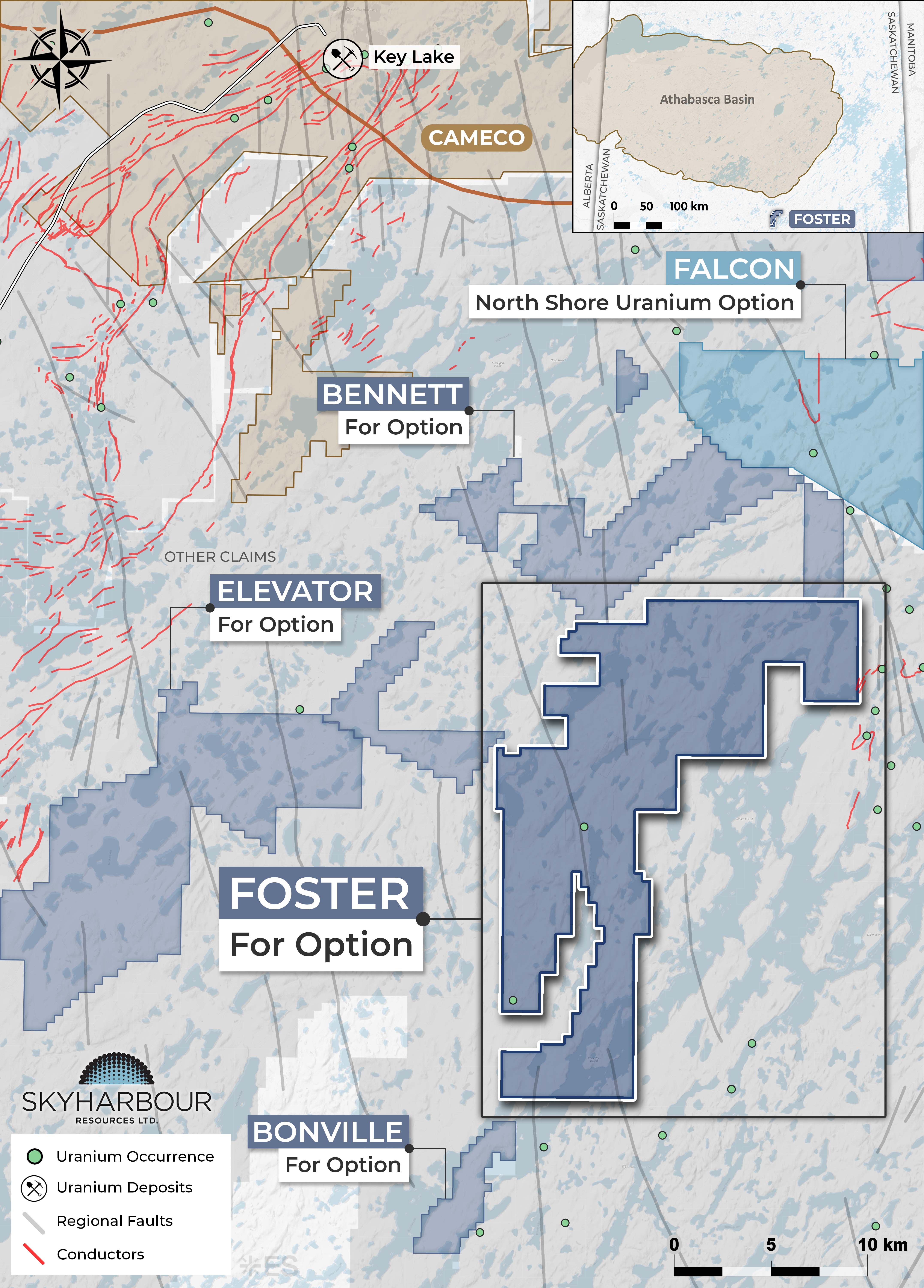
Foster
The drill-ready Foster property consists of 13 claims totalling 15,582 hectares, approximately 20 km southeast of Cameco's Key Lake operation and adjoining the southwestern end of Skyharbour's Falcon Project, which is currently optioned to North Shore Uranium.
Learn More
Bennett
Skyharbour has staked five additional claims totalling 12,624 hectares at its Bennett Project, increasing the property to seven claims totalling 17,657 hectares.
Learn More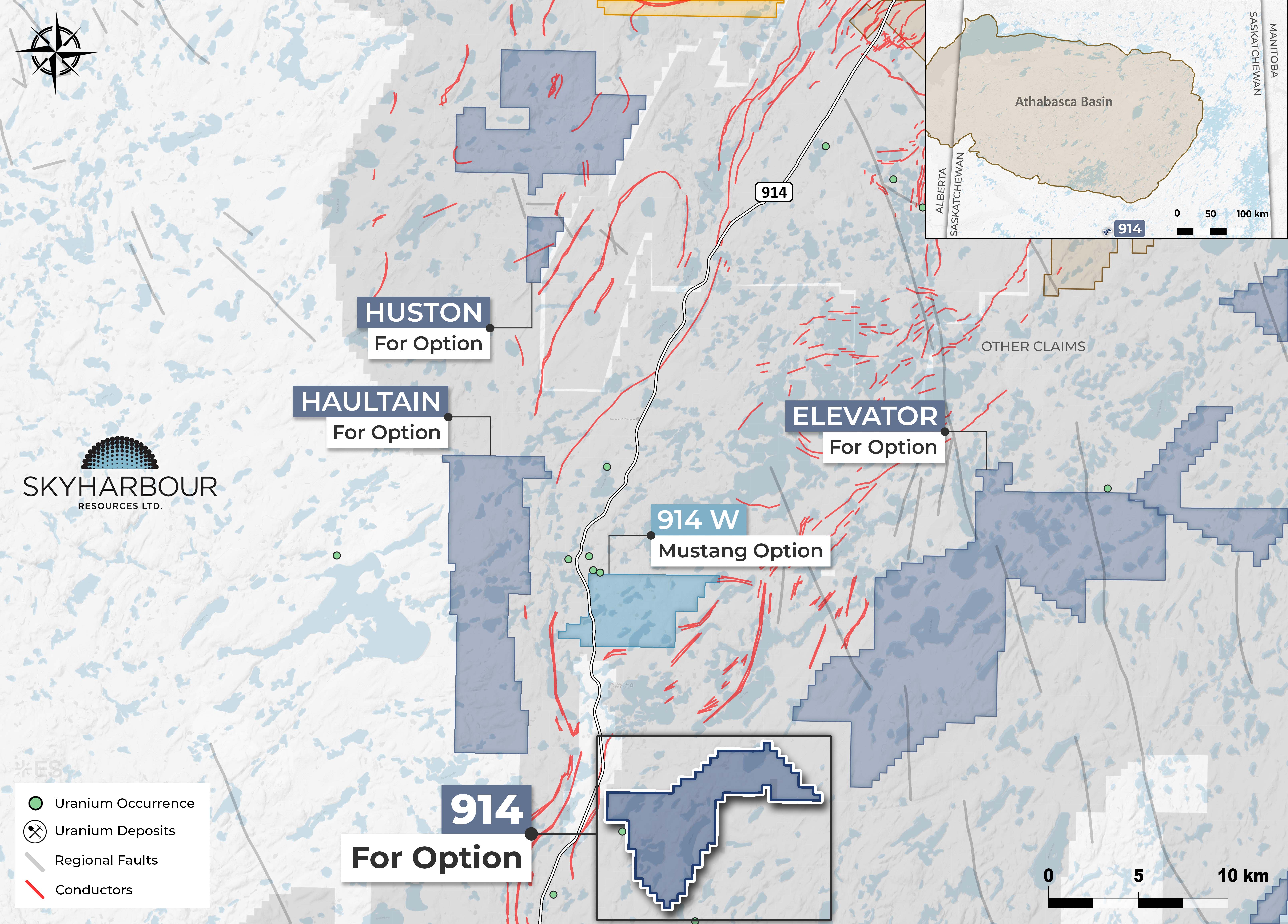
914 & Elevator
The 914 and Elevator Projects now comprise a total of 14 claims forming two contiguous claim blocks, covering 18,481 hectares. The 914 Project consists of seven contiguous claims totaling 4,031 hectares. The Elevator Project consists of seven claims totaling 14,450 hectares. Both projects are located 35 to 55 km south of Cameco’s Key Lake Operation.
Learn More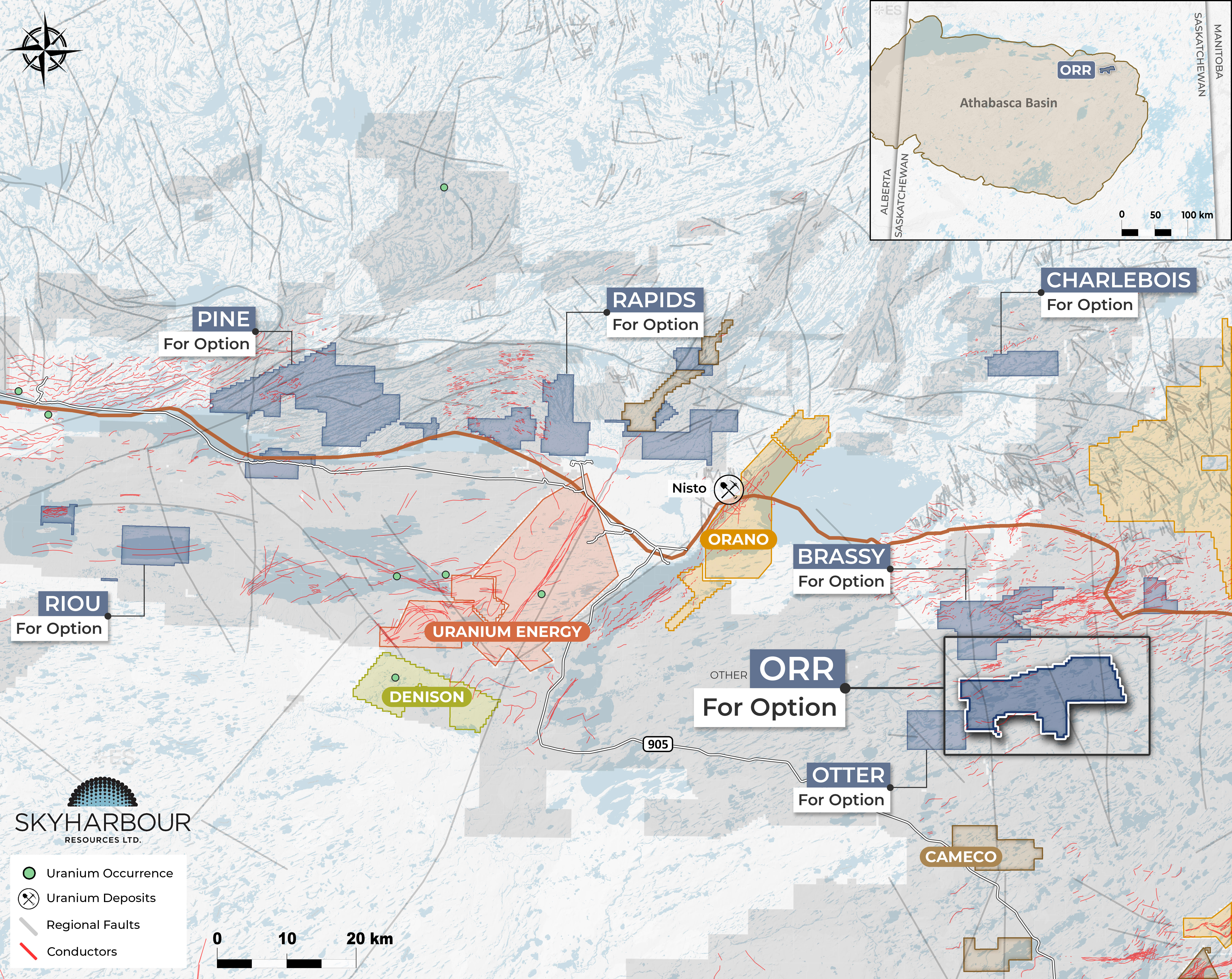
Orr
The Orr project comprises three claimstotalling 15,347 hectares located in the northern Athabasca Basin, approximately 46 km southeast of the community of Black Lake.
Learn More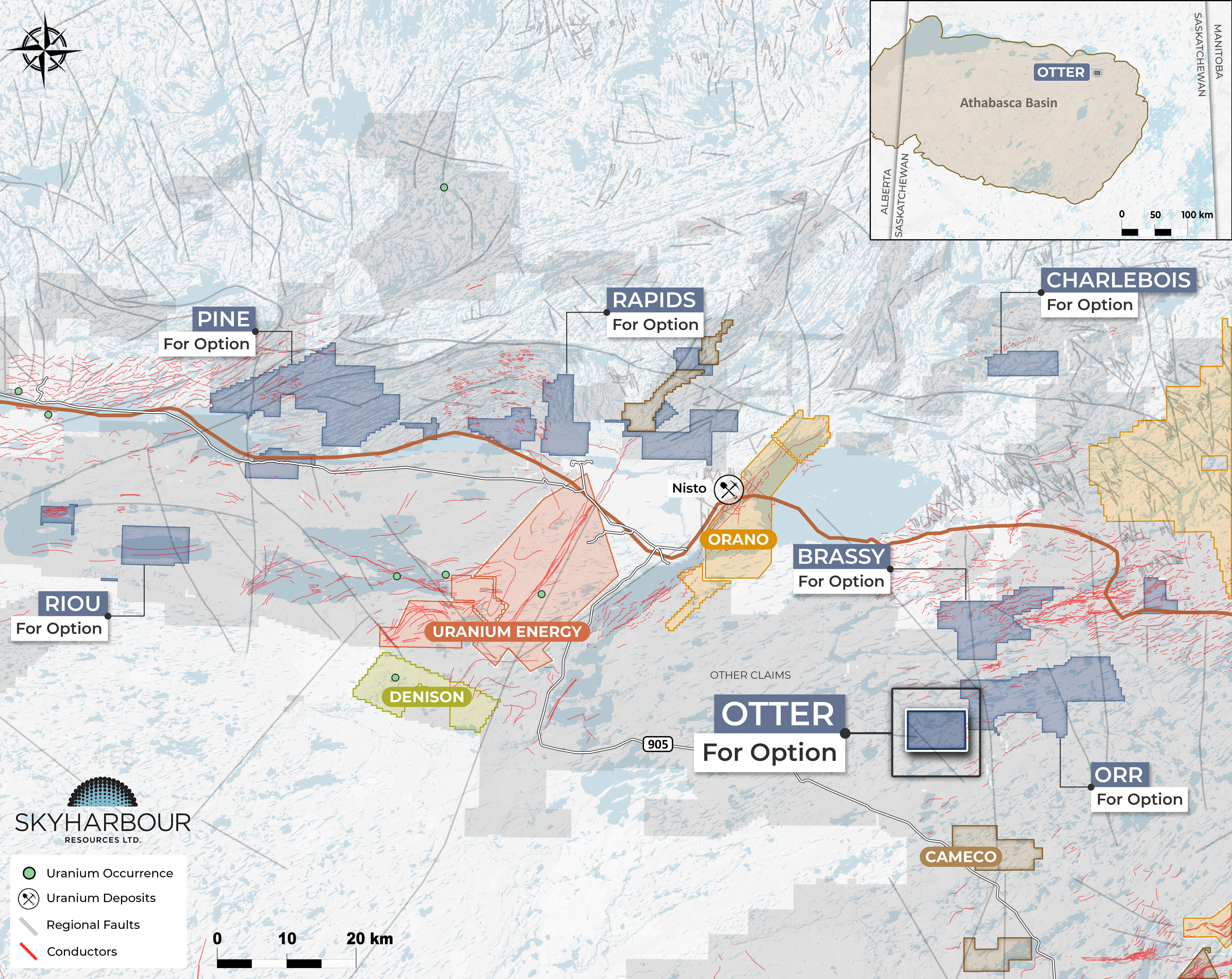
Otter
The Otter Project consists of one claim totalling 4,838 hectares located in the northern Athabasca Basin approximately 41 km southeast of the community of Black Lake.
Learn More
Pendleton
The Pendleton Project consists of four non-contiguous mineral claims totalling 5,338 hectares and is located approximately 70 km southeast of Cameco’s Key Lake Operation and 114 km northwest of the community of Southend.
Learn More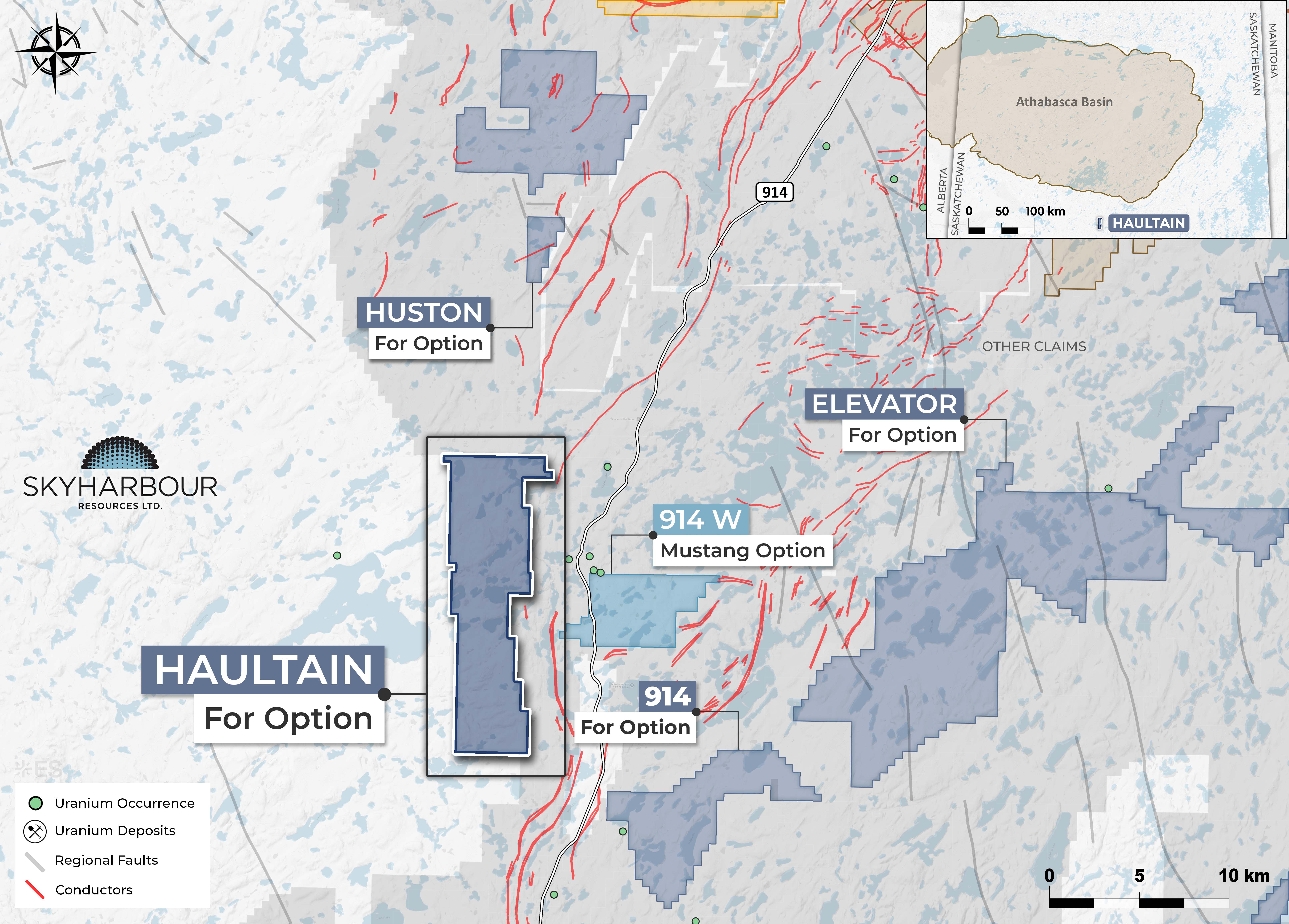
Haultain
The Haultain Project comprises five newly staked claims totalling 6,607 hectares, located approximately 46 km southwest of Cameco’s Key Lake Operation and 3 km west of Highway 914.
Learn More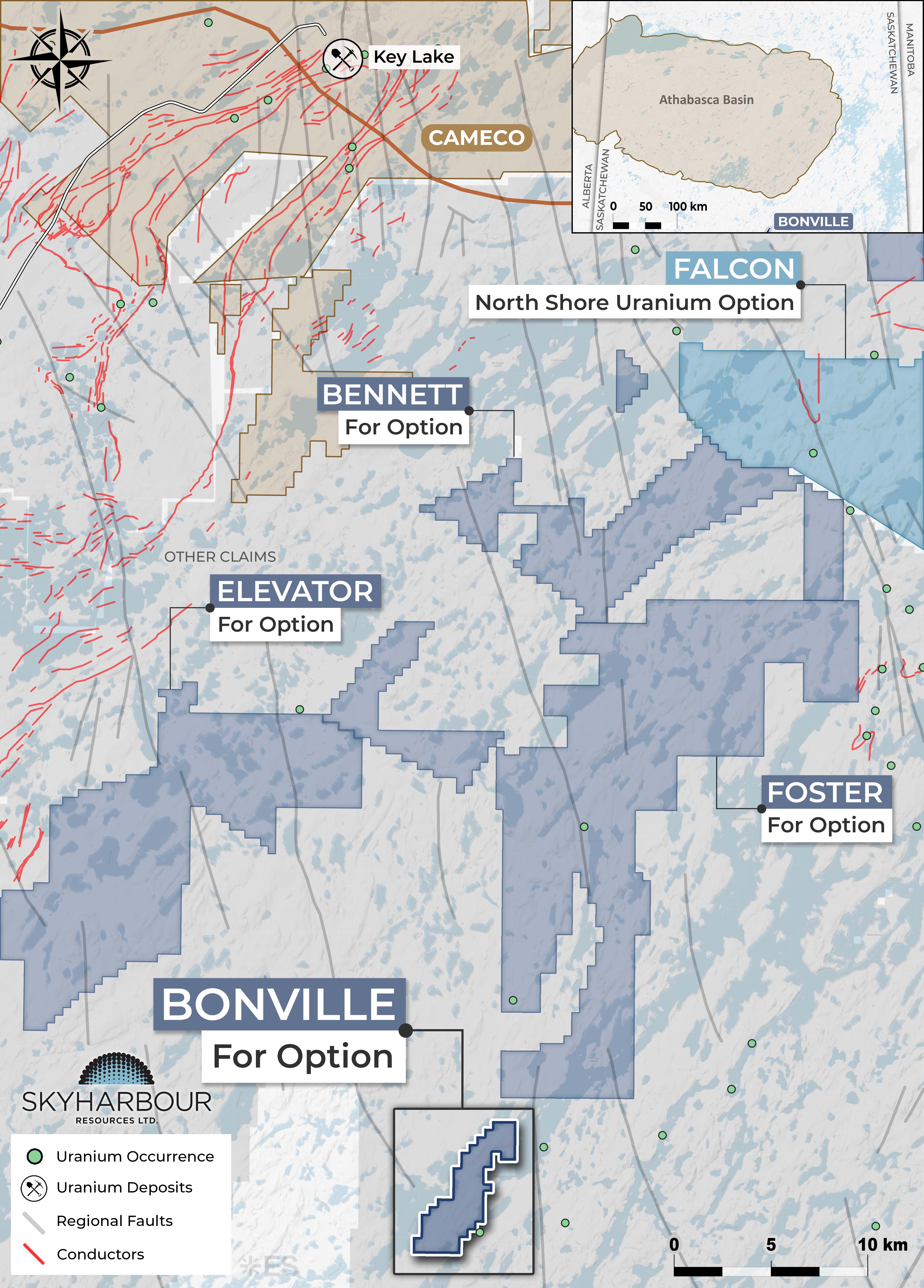
Bonville
The Bonville Project consists of a single newly staked claim totalling 1,497 hectares and is located approximately 60 km south of Cameco’s Key Lake Operation.
Learn More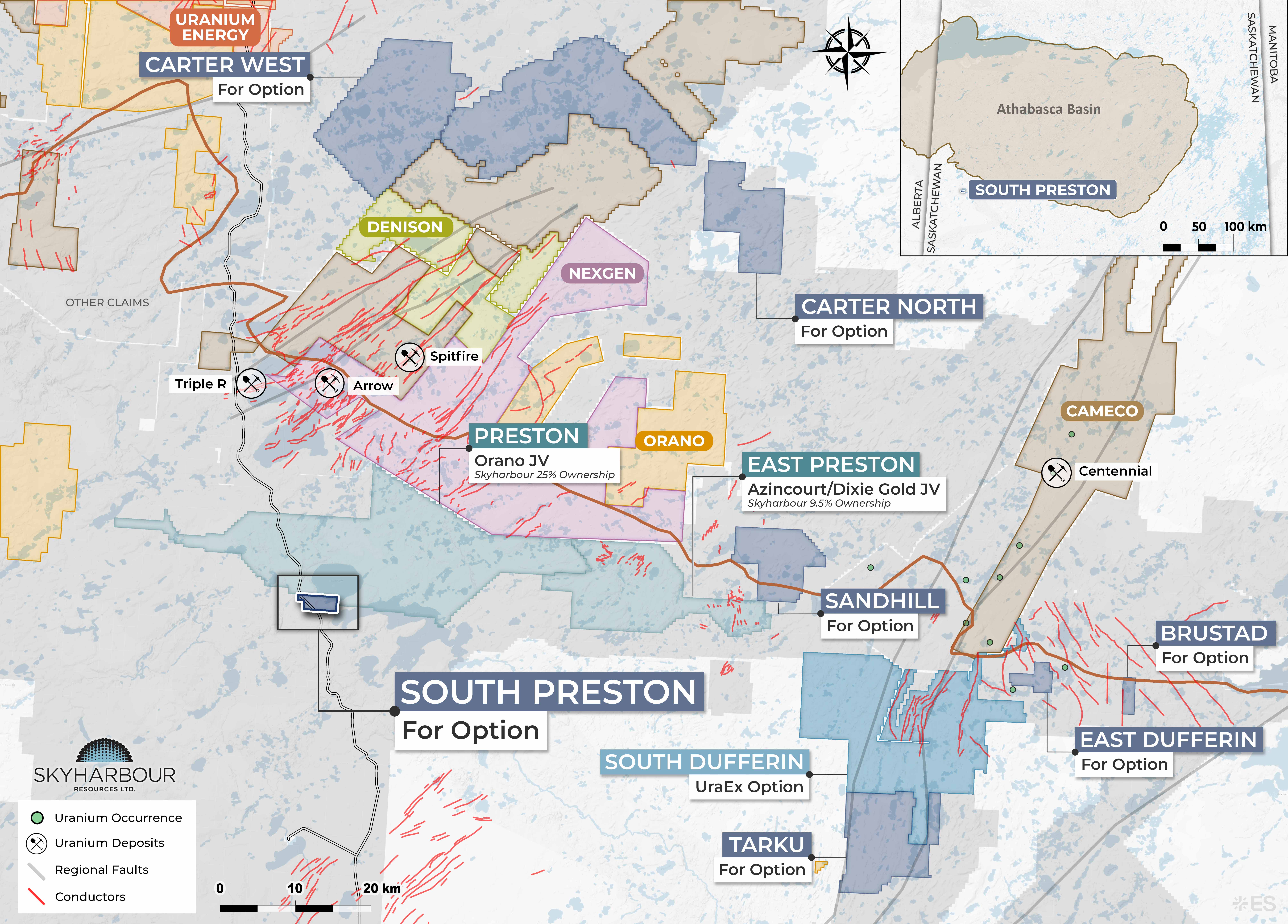
South Preston
The South Preston Project consists of one claim totalling 965 hectares, located approximately 30 km south of the Athabasca Basin and adjacent to Skyharbour and Orano Canada’s Preston Joint Venture.
Learn More
Rover
The newly staked Rover Project consists of a single claim totalling approximately 792 hectares located approximately 40 kilometres east of Cameco’s McArthur River Mine, 31 kilometers southeast of Cigar Lake Mine, and 68 kilometers west of the community of Wollaston Lake.
Learn More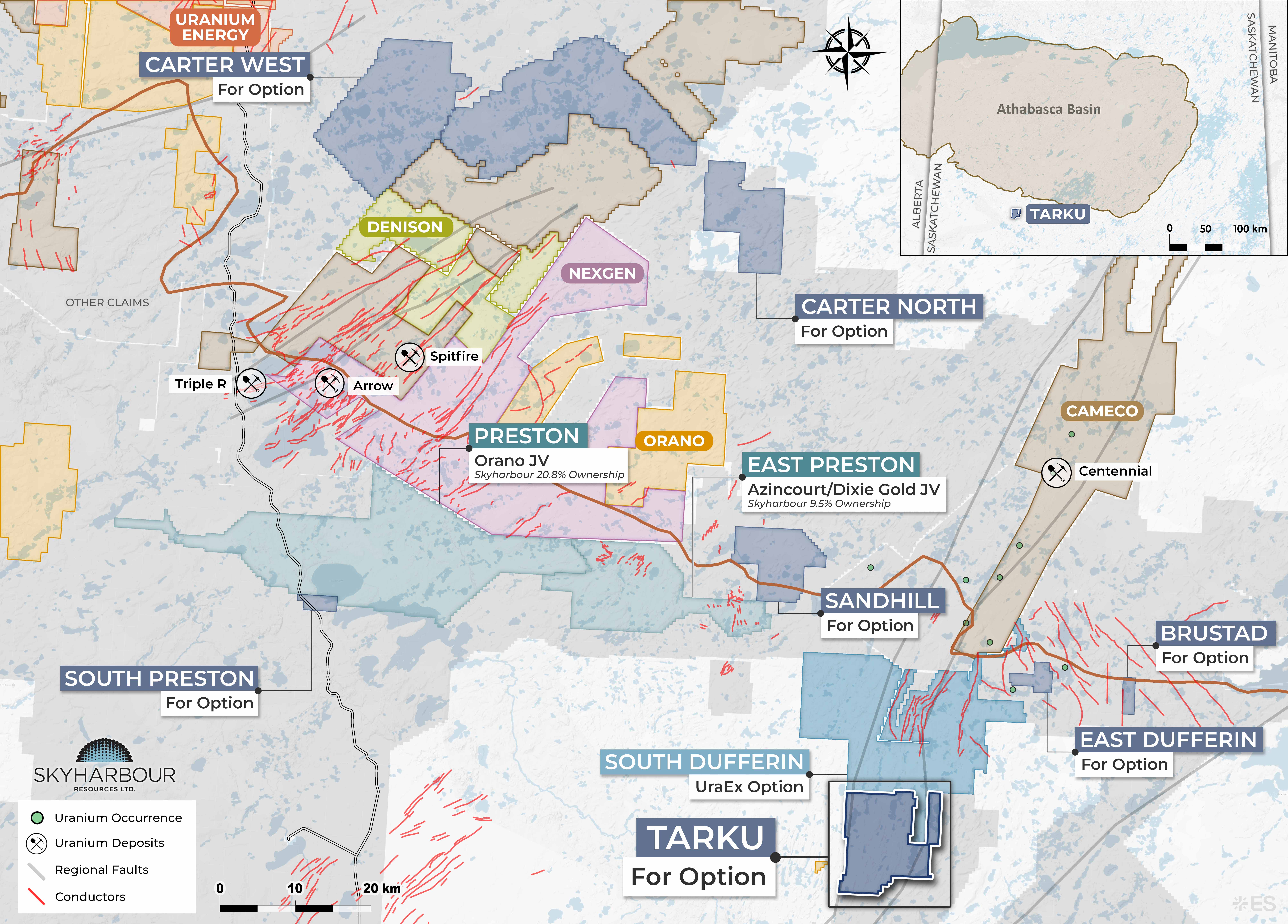
Tarku
The Tarku Project consists of four claims, totalling 13,337 hectares and is located adjacent to Skyharbour’s South Dufferin Project, which is currently under option to UraEx Resources.
Learn More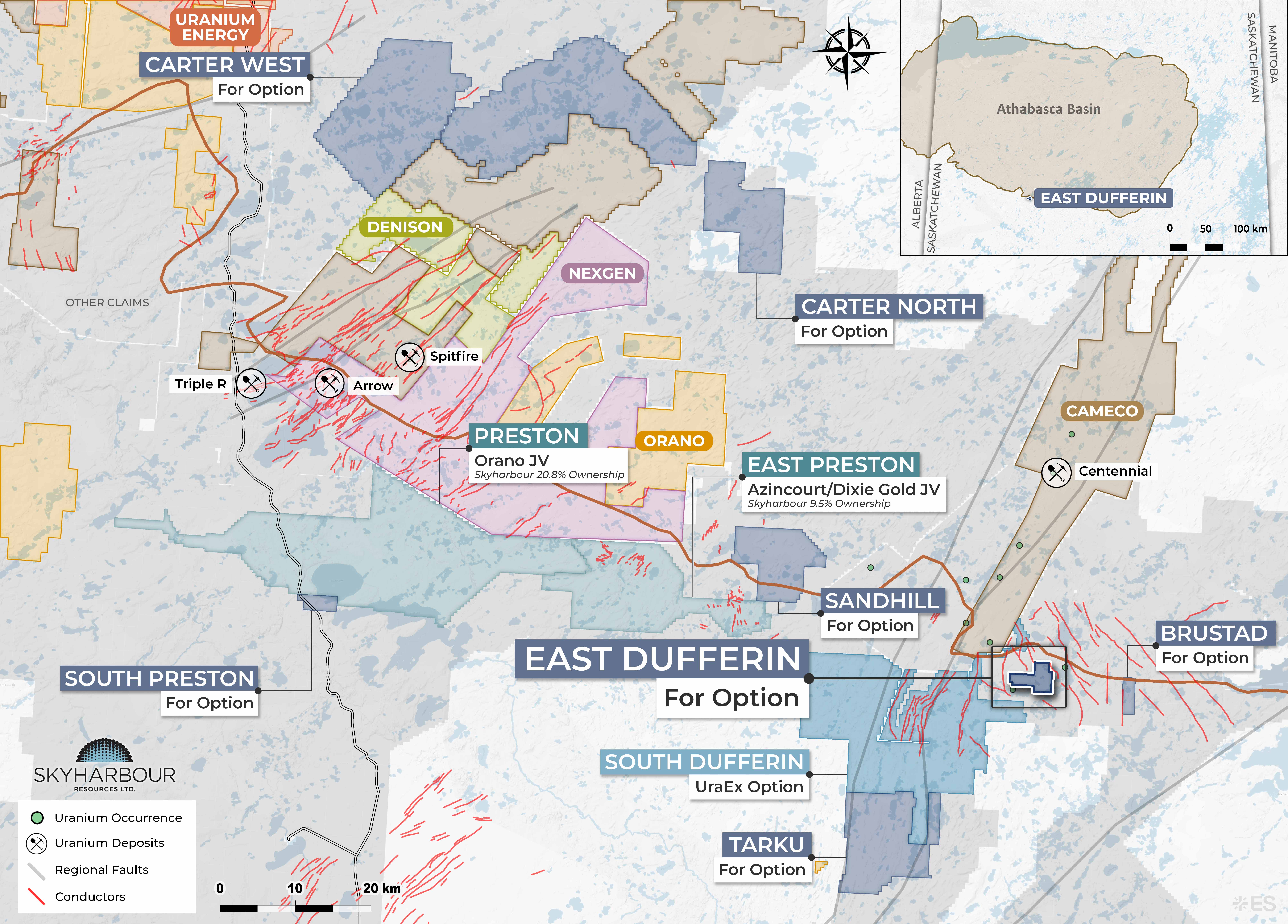
East Dufferin
The East Dufferin Project consists of a single newly staked claim totalling 1,450 hectares and is located immediately south of the southern margin of the Athabasca Basin in northern Saskatchewan, approximately 4 km west of Skyharbour’s South Dufferin project, which is currently under option to UraEx Resources.
Learn More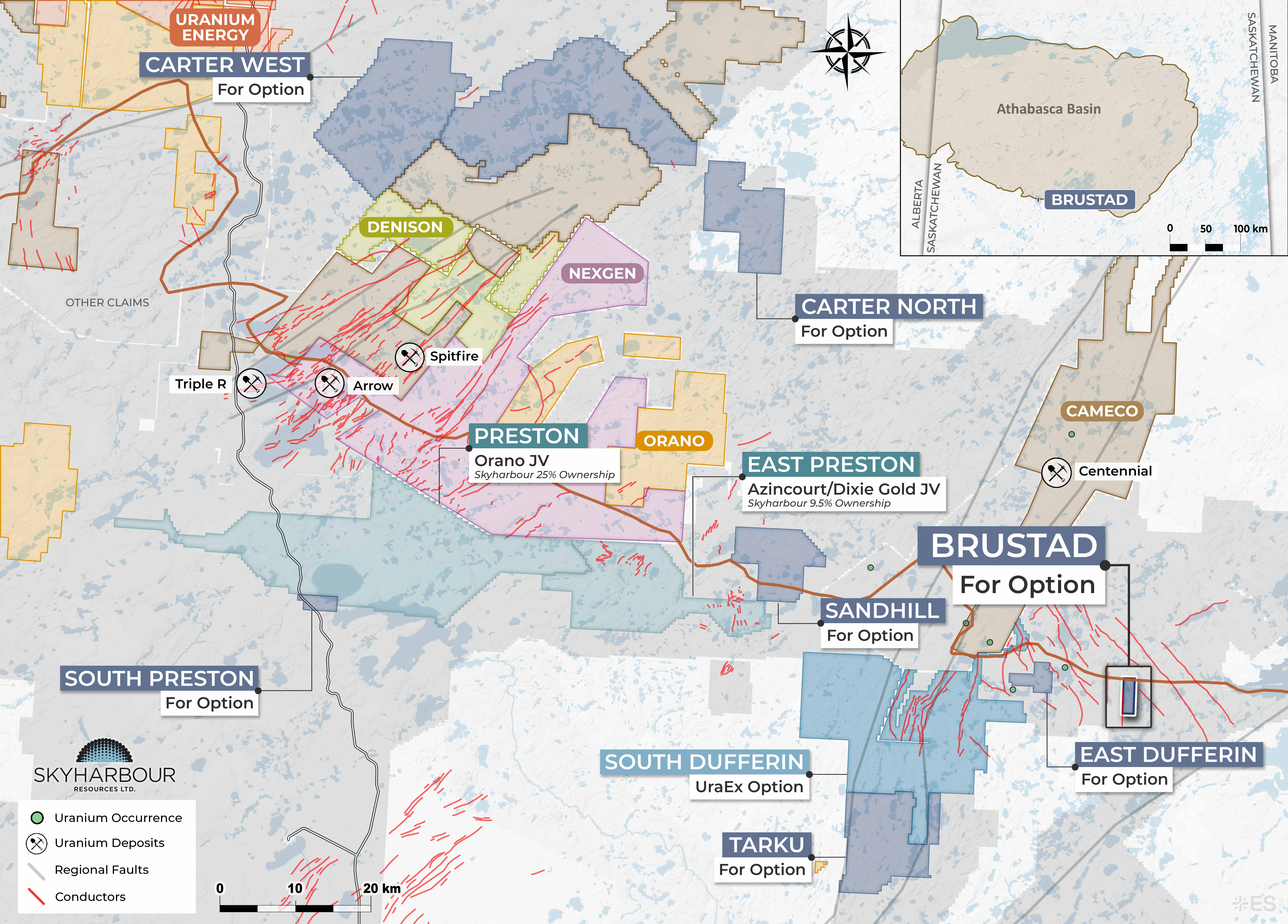
Brustad
The Brustad project consists of one newly staked mineral claim totaling 791 hectares, located approximately 21 km east of Skyharbour’s South Dufferin property.
Learn More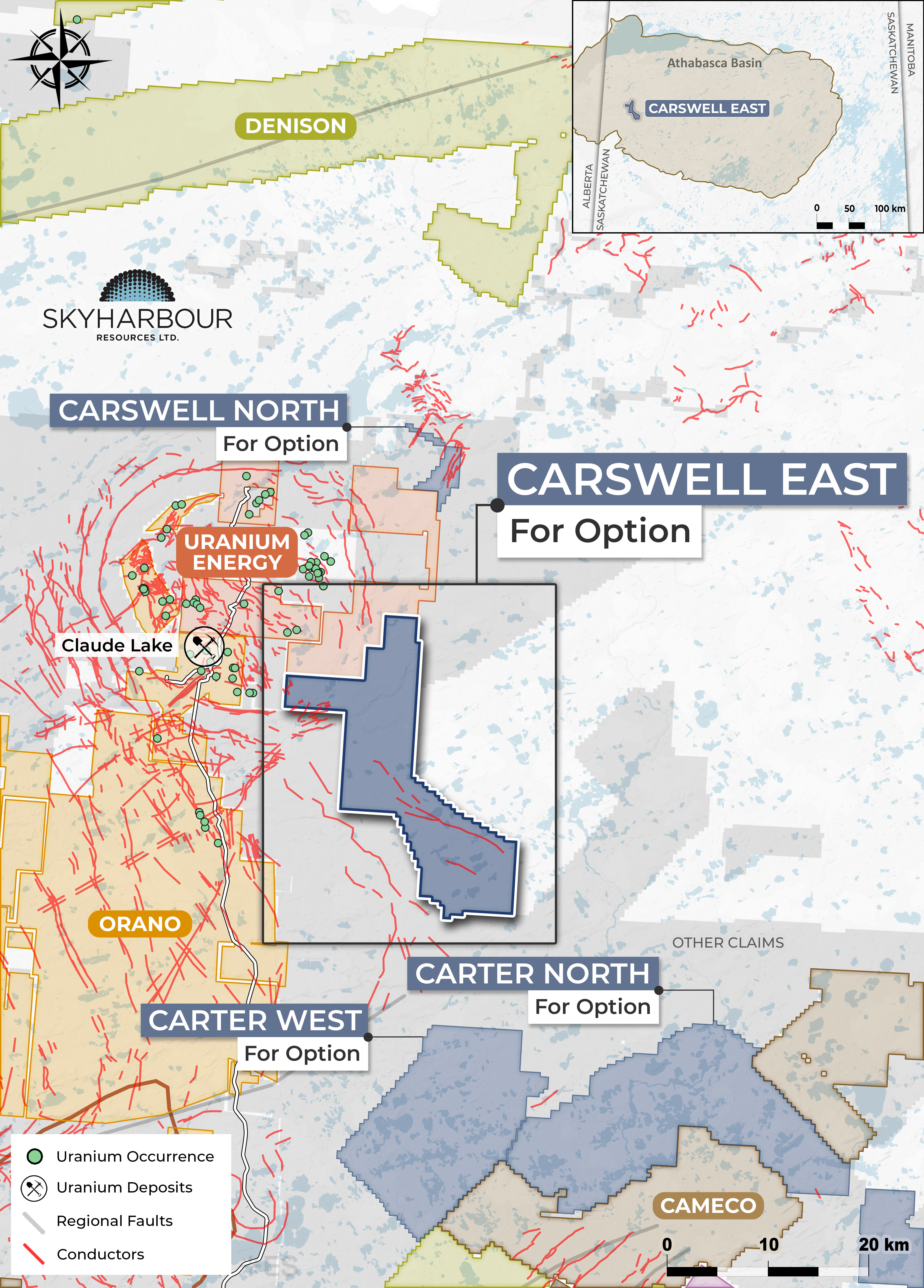
Carswell East
The Carswell East Project consists of five claims totalling 23,666 hectares in the western Athabasca Basin, approximately 9 km east of the former Cluff Lake uranium mine complex and Highway 955, 197 km north of La Loche, and 216 km northeast of Fort McMurray.
Learn More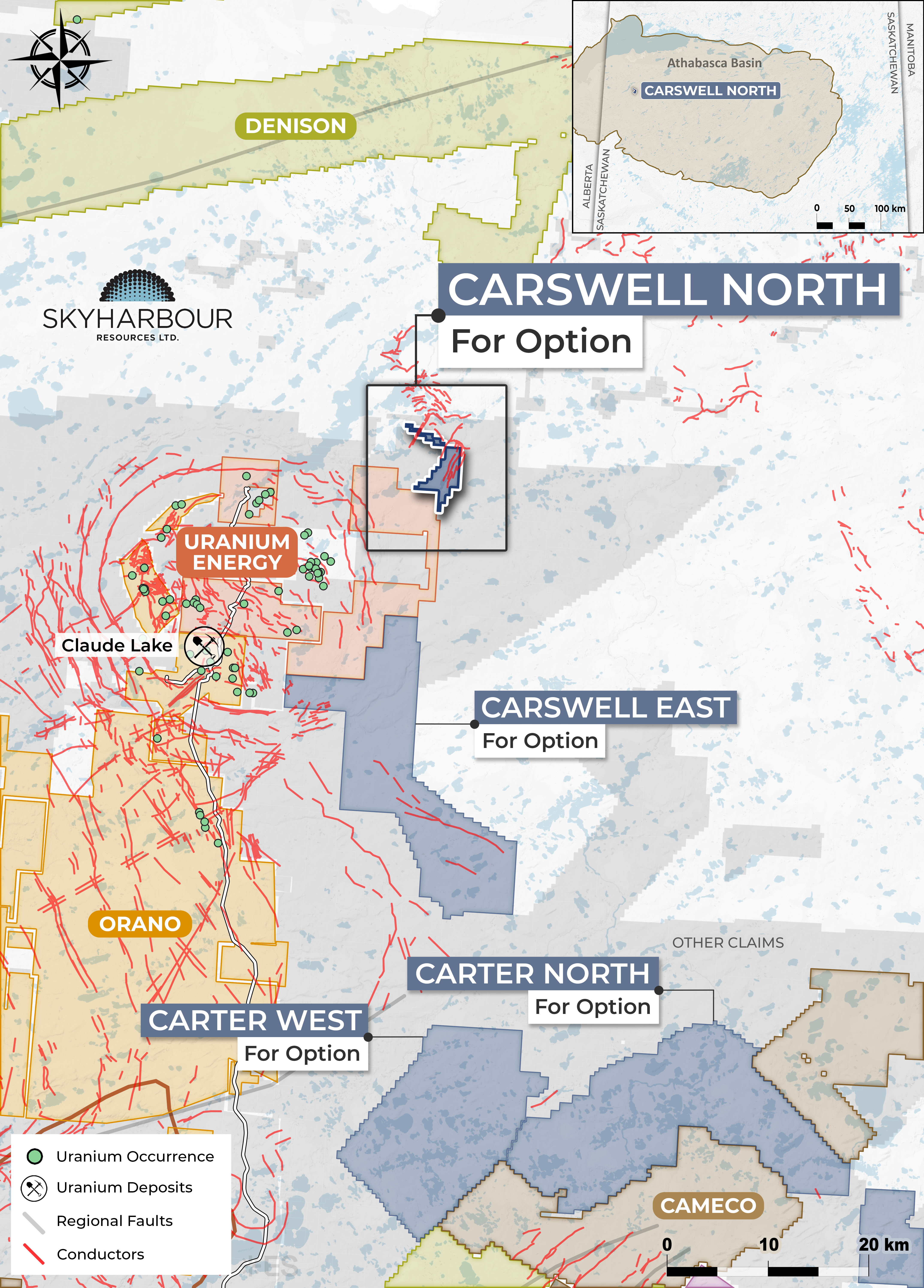
Carswell North
The Carswell North Project consists of a single claim totalling 1,544 hectares in the western Athabasca Basin, approximately 28 km northeast of the former Cluff Lake mine complex, 260 km northeast of Fort McMurray, and 230 km north of La Loche.
Learn More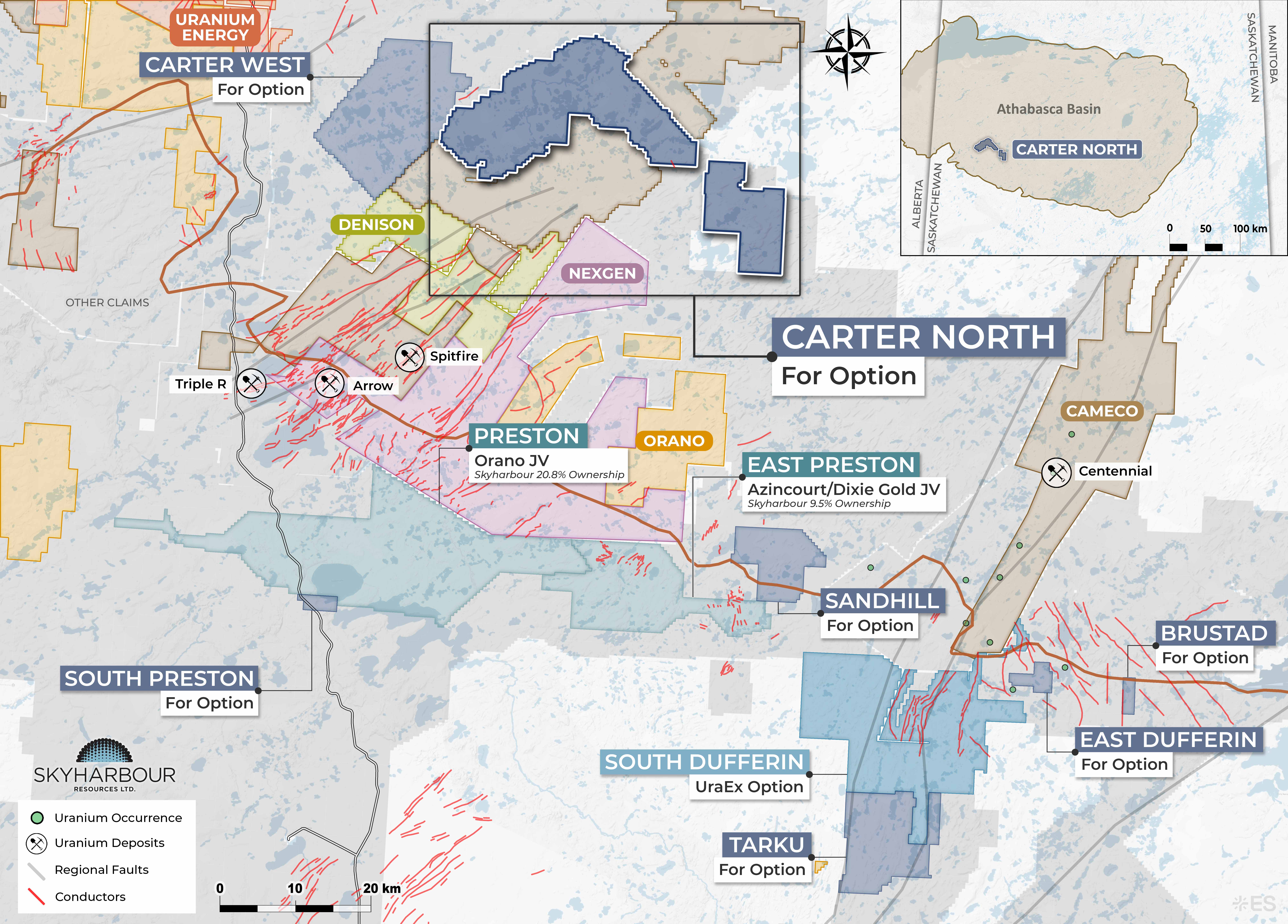
Carter North
Skyharbour has staked two additional claims totalling 6,350 hectares at its Carter North Project, increasing the property to twelve claims totalling 42,742 hectares.
Learn More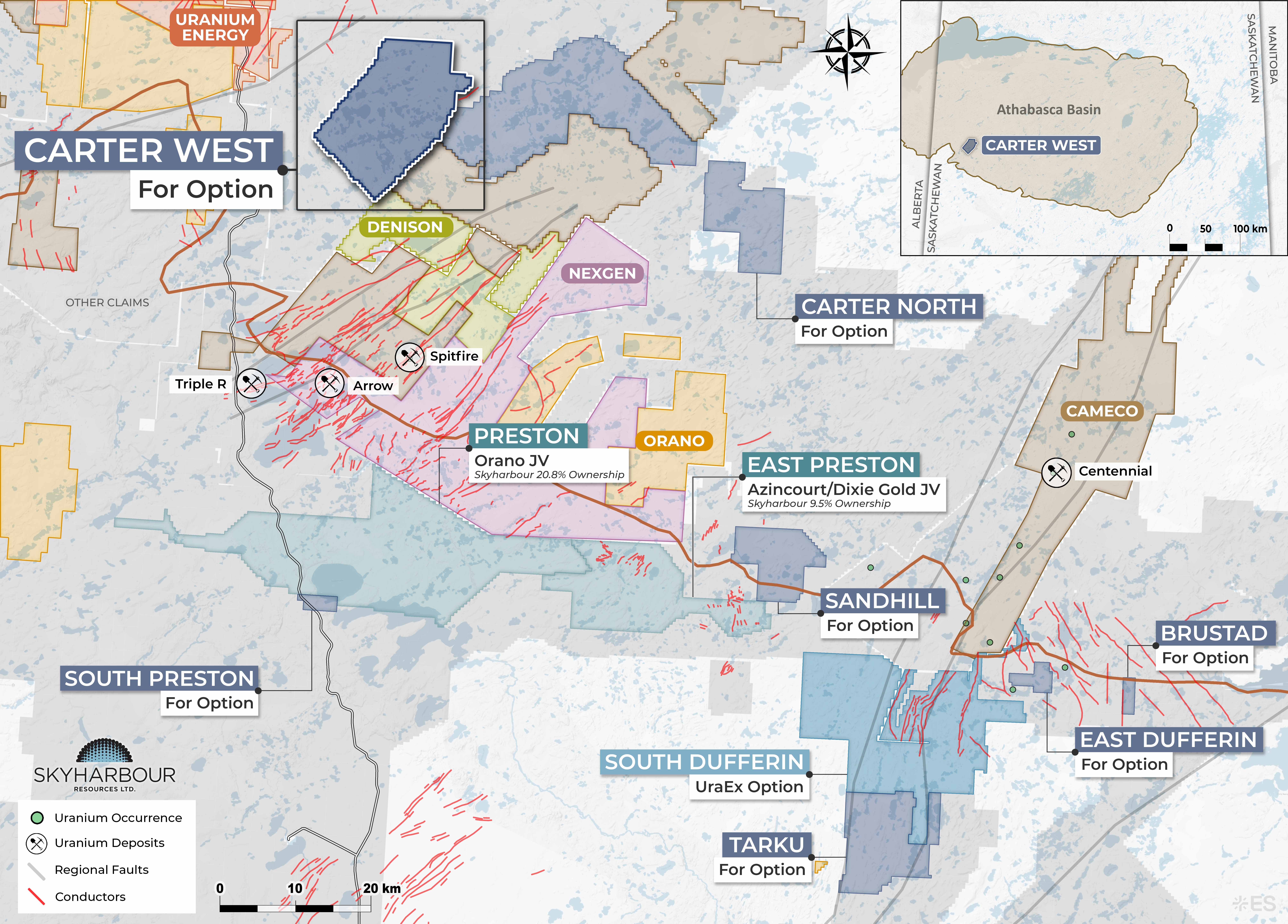
Carter West
The Carter West Project comprises six mineral claims totaling 24,397 hectares along the western margin of the Athabasca Basin, approximately 24 km northeast of the Athabasca Basin boundary.
Learn More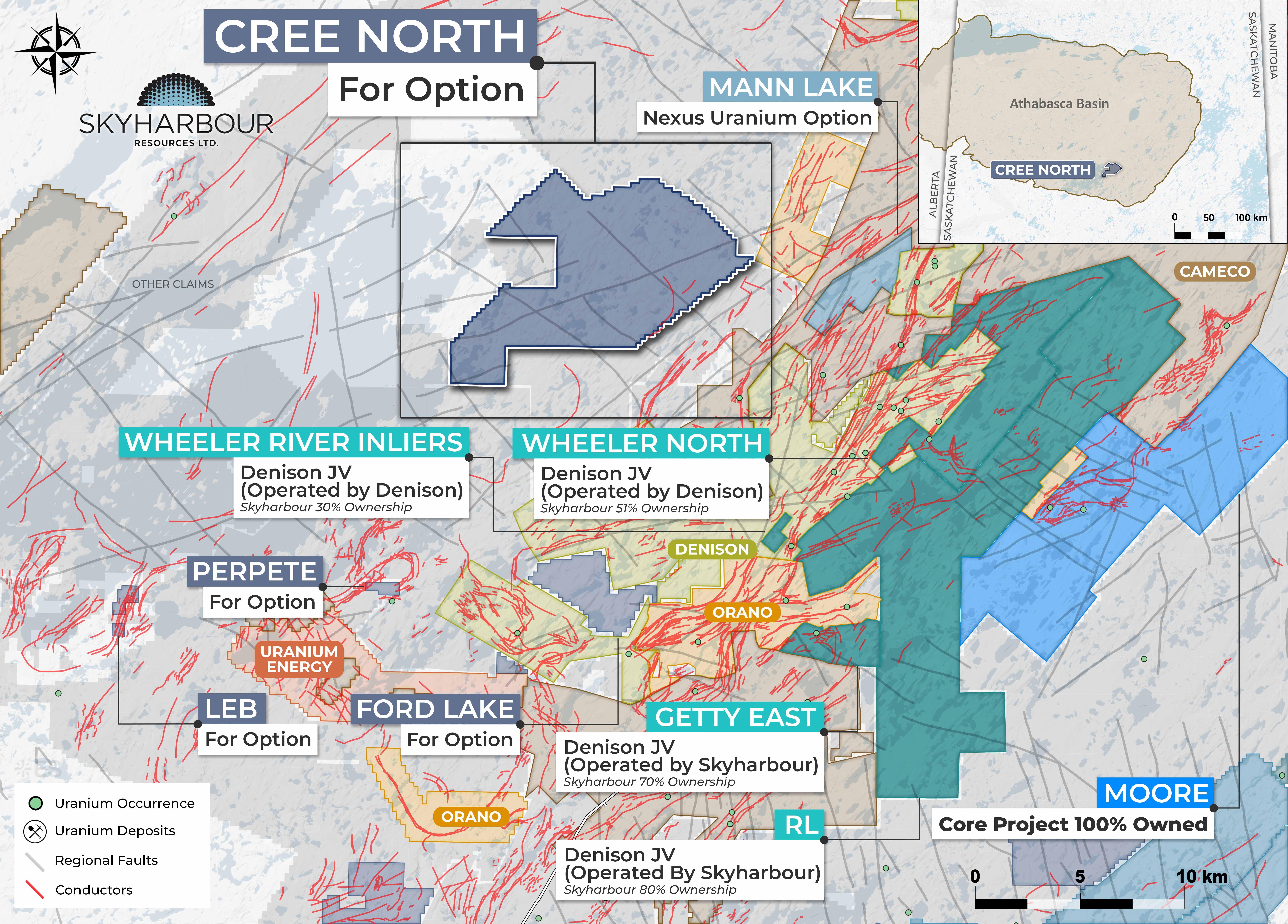
Cree North
The Cree North Project consists of seven contiguous claims totalling 30,204 hectares.
Learn More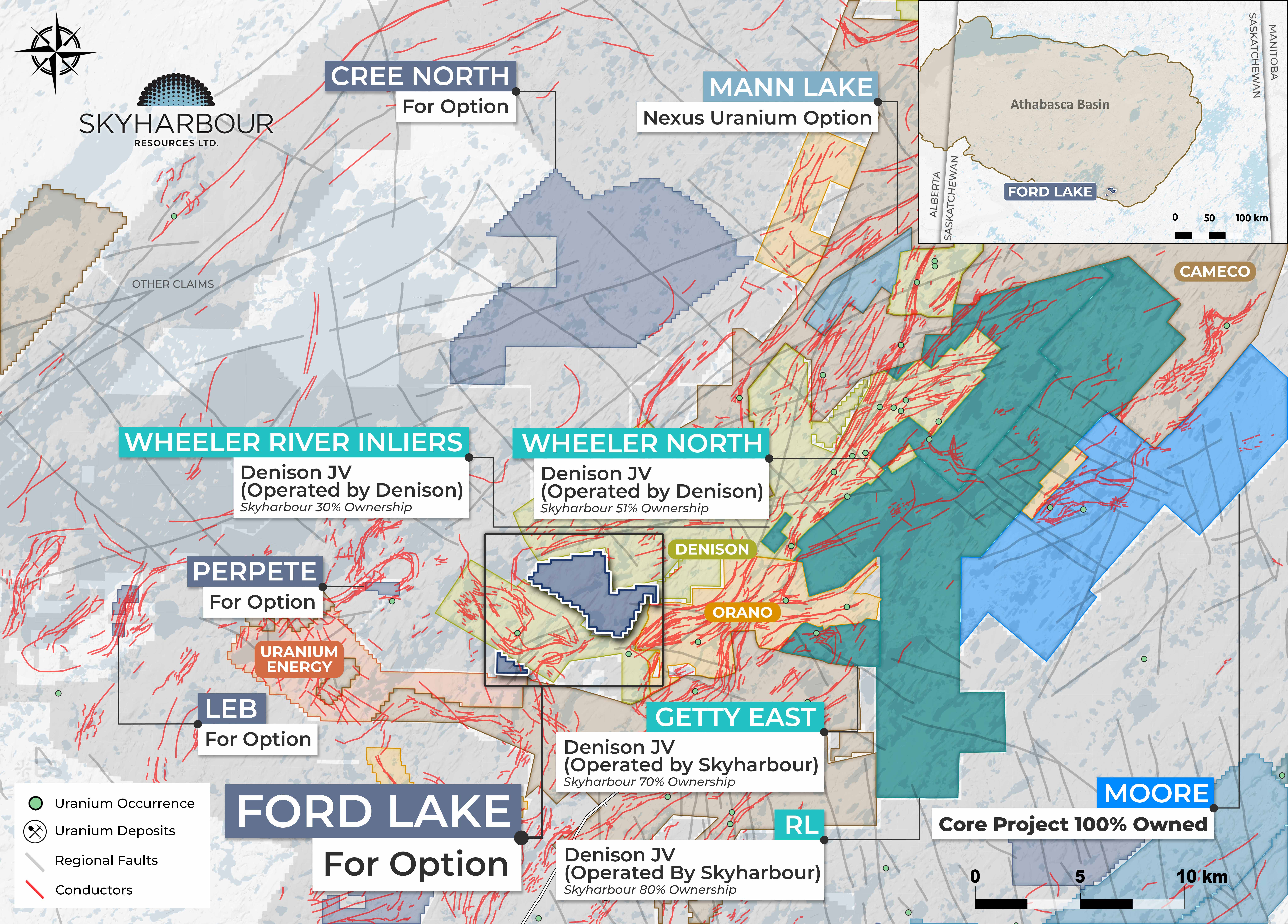
Ford Lake
Ford Lake consists of three claims in the southeastern Athabasca Basin totaling 4,921 hectares, including two contiguous claims and one claim located approximately 7 km southwest of the northern claims.
Learn More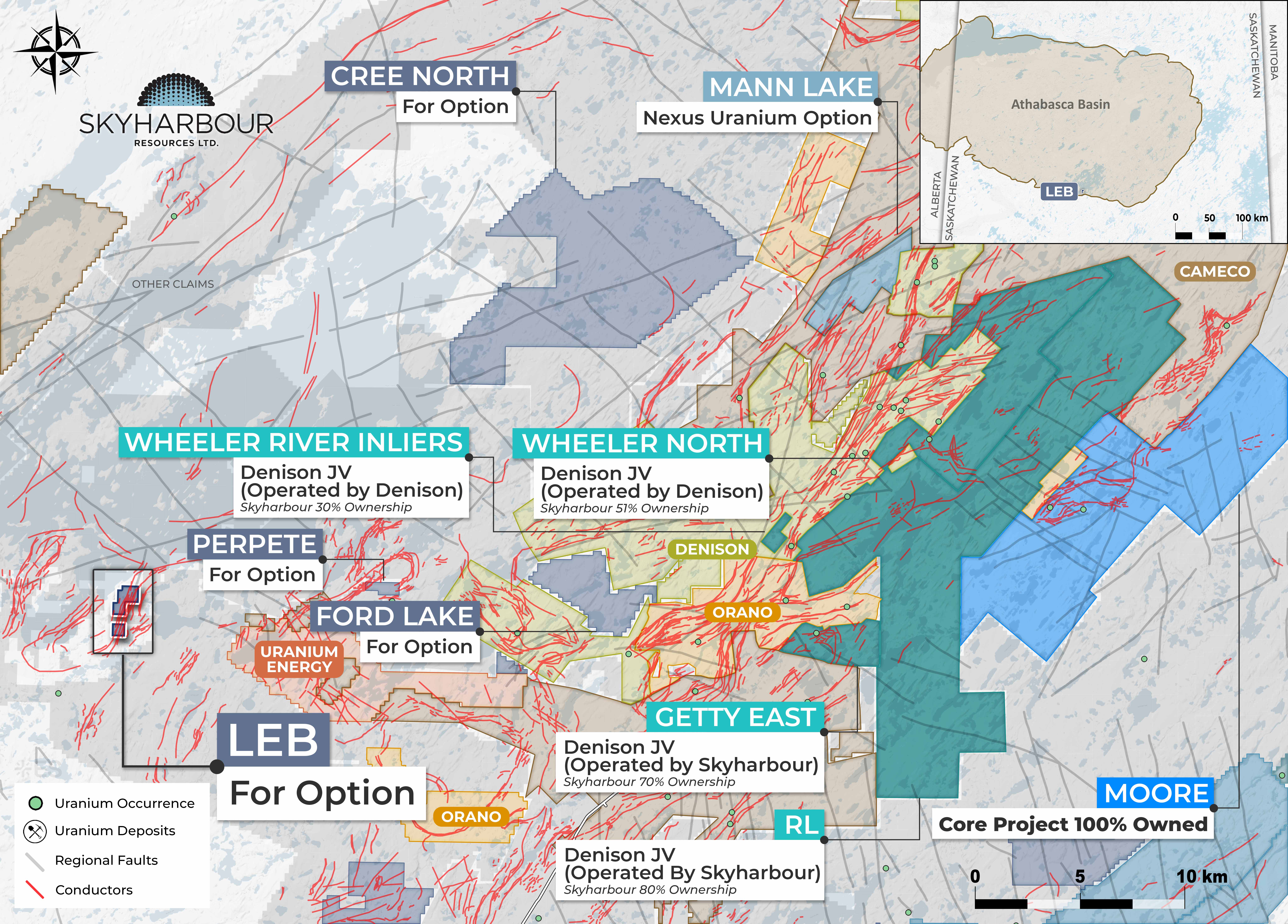
LEB
The LEB Project consists of two mineral claims totaling 607 hectares along the southern margin of the Athabasca Basin, approximately 60 kilometres west of the Key Lake Mine and Mill.
Learn More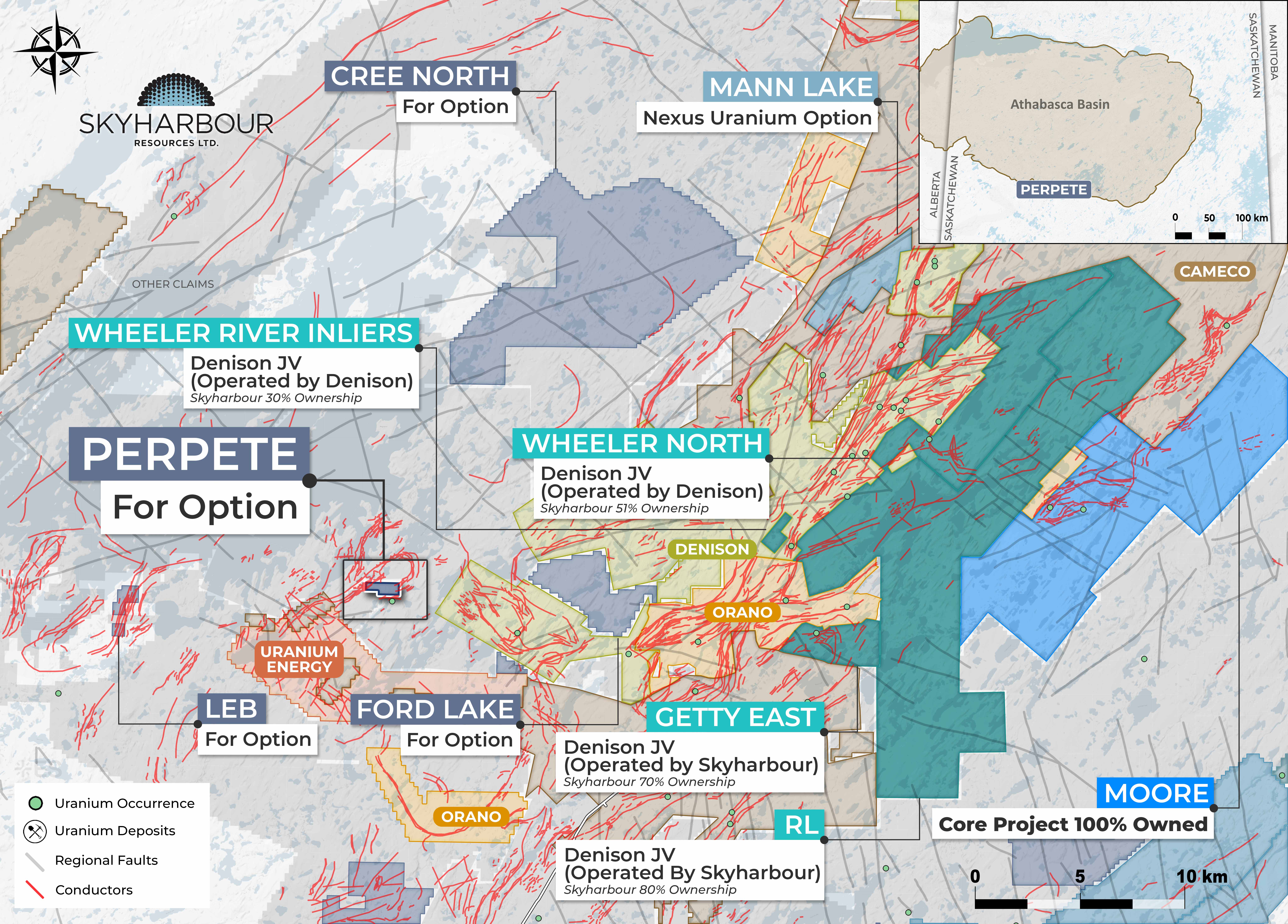
Perpete
The Perpete Project comprises a single claim totaling 351 hectares within the southeastern Athabasca Basin.
Learn More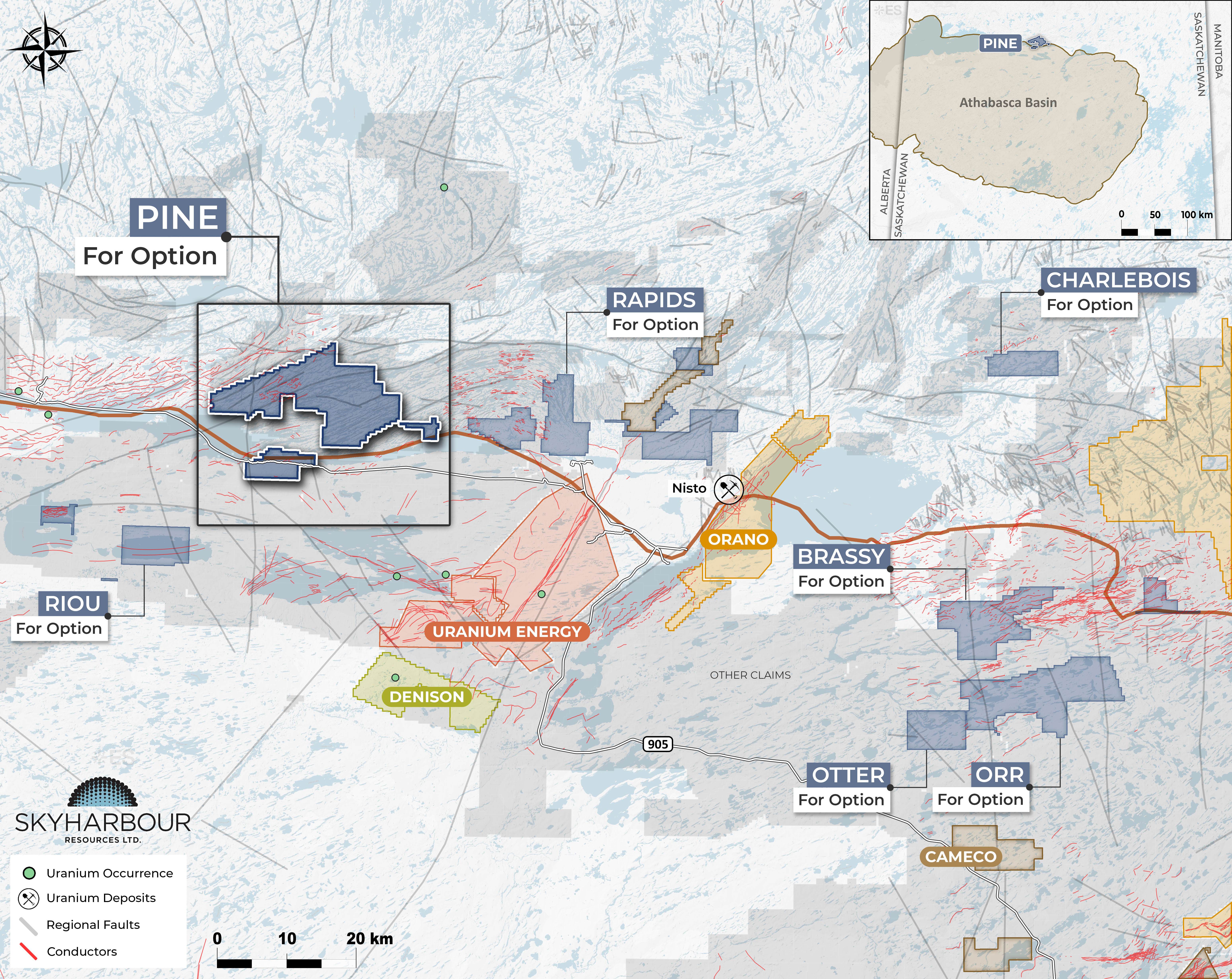
Pine
The Pine Project consists of seven mineral claims totaling 23,817 hectares located along the northern margin of the Athabasca Basin.
Learn More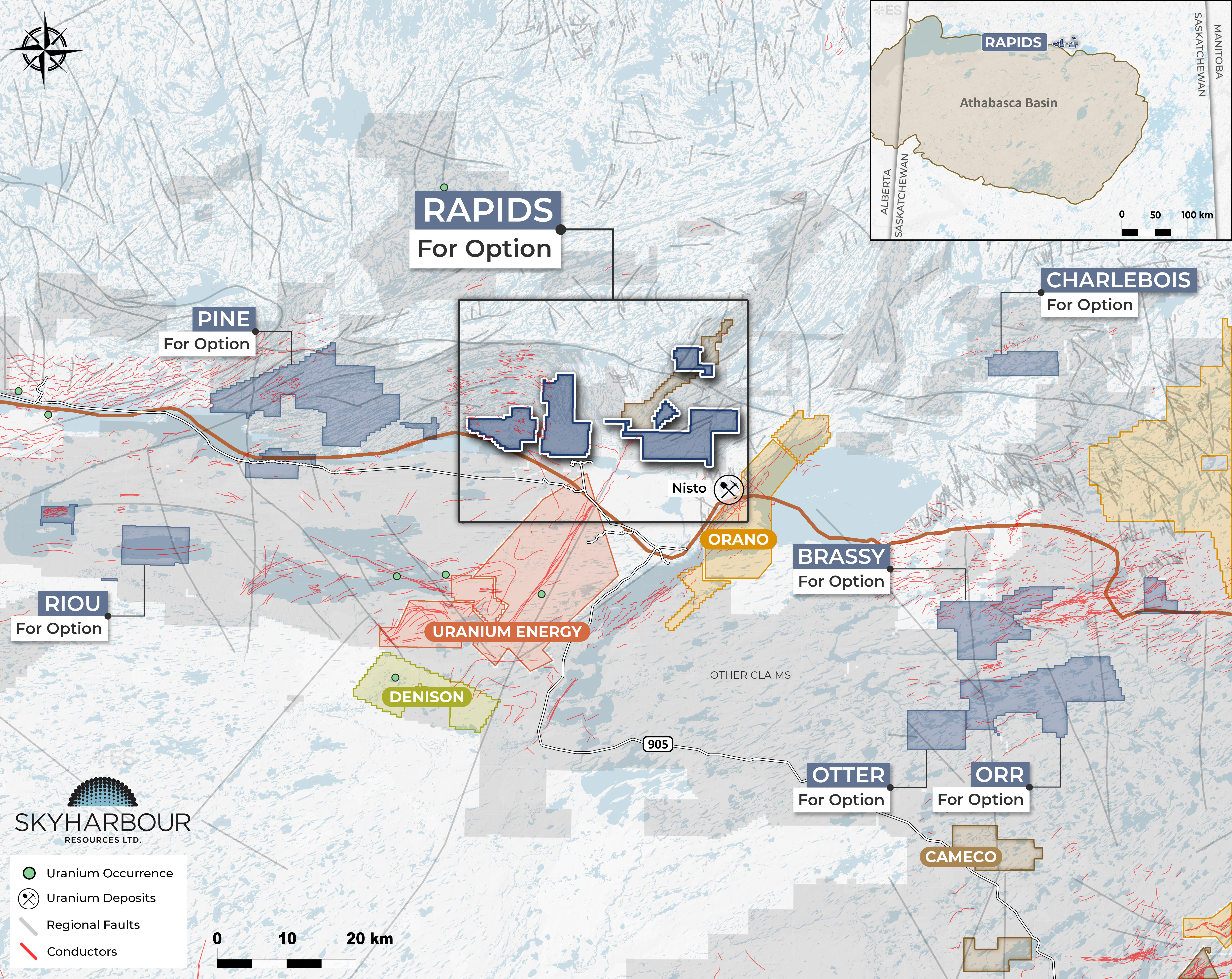
Rapids
The Rapids Project consists of eight claims totalling 18,504 hectares in northern Saskatchewan.
Learn More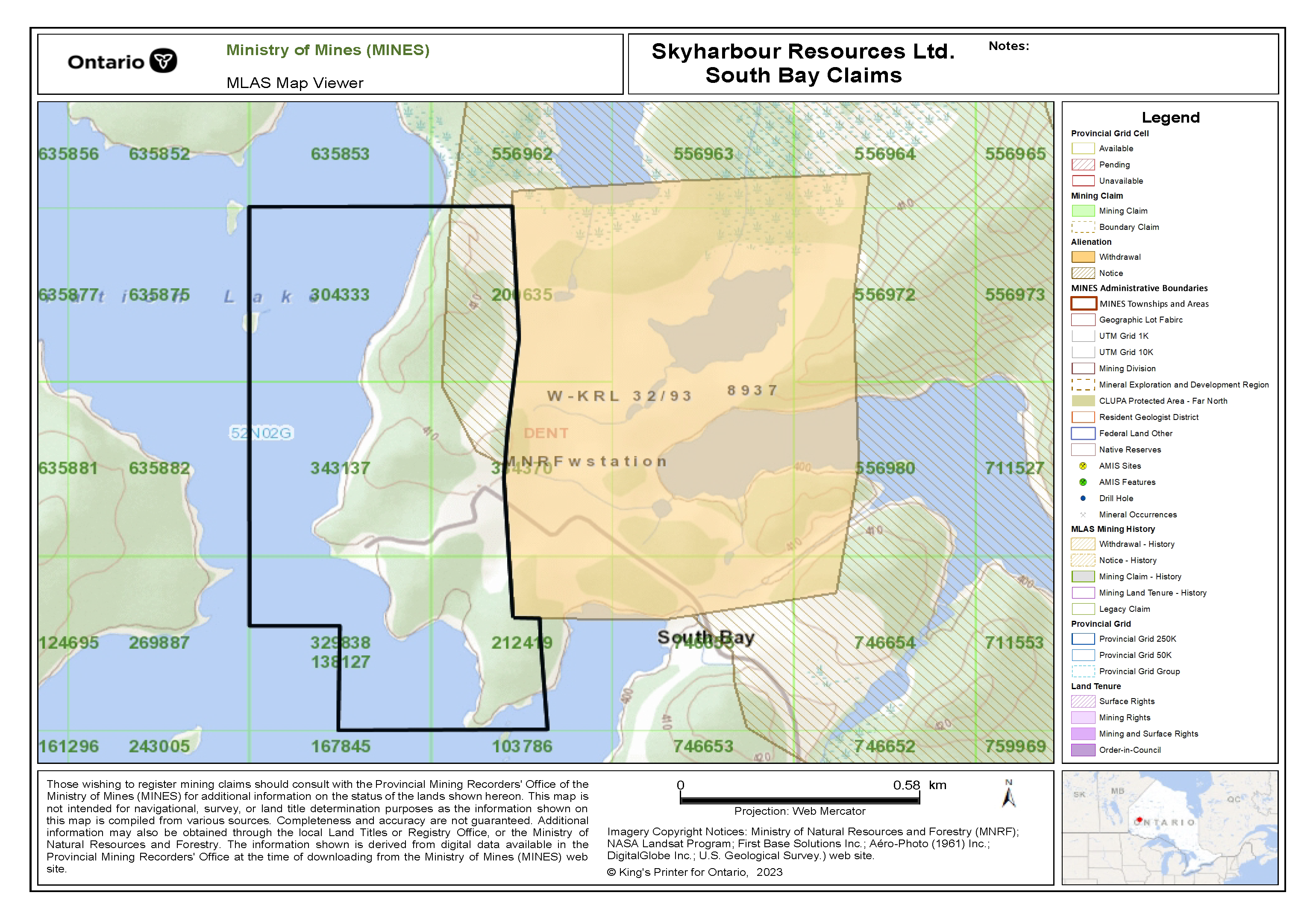
South Bay
Skyharbour holds a 100% interest in the 84 hectares South Bay Project consisting of six claims around the past-producing Selco South Bay copper-zinc-silver mine.
Learn More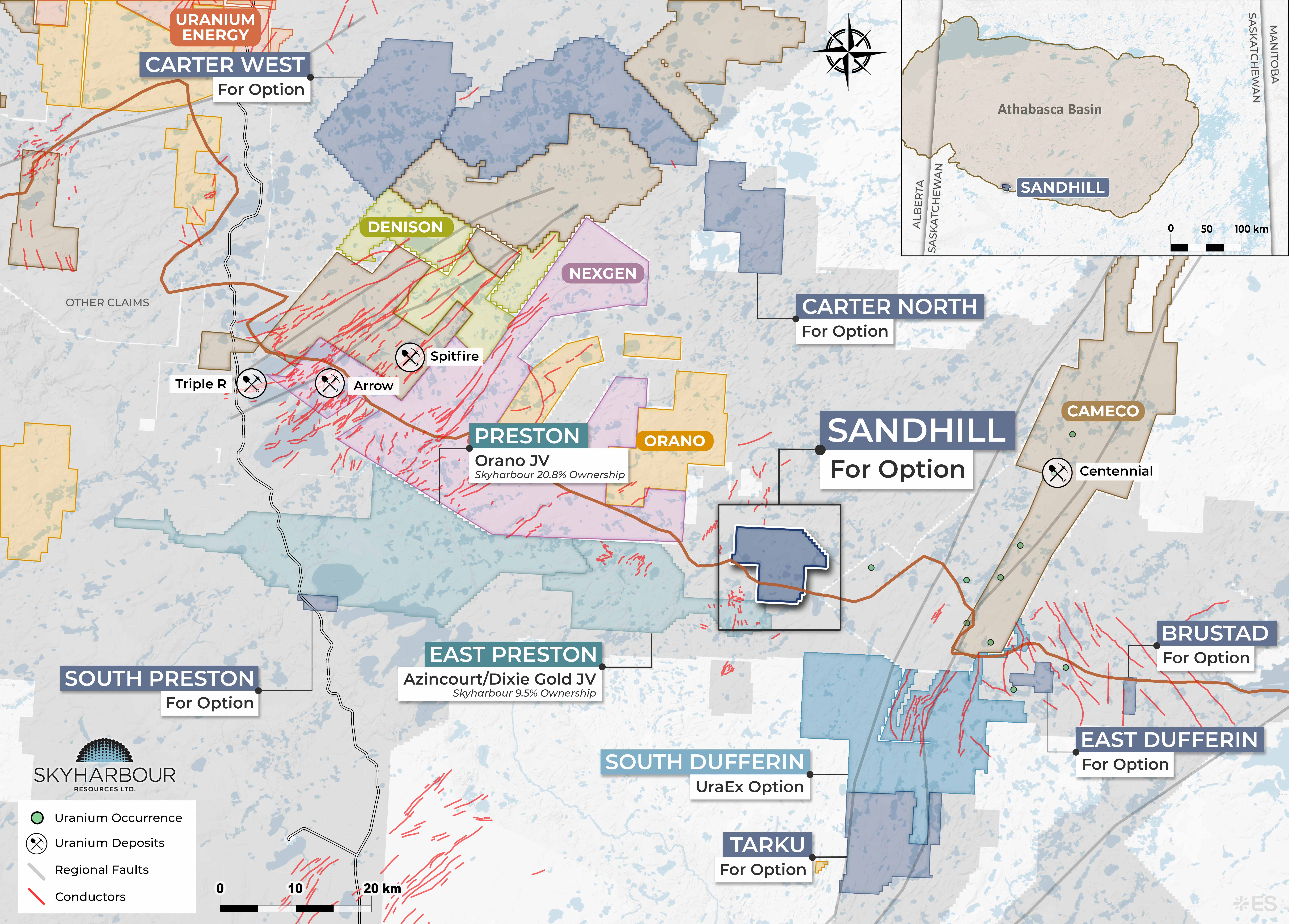
Sandhill
The Sandhill Project was staked by Skyharbour in July 2026 and consists of three claims totalling 8,287.6 ha.
Learn More
Gallagher
The Gallagher Project consists of five claims totalling 7,941.8 ha located in the Gallagher Lake area, immediately northeast of Wollaston Lake.
Learn More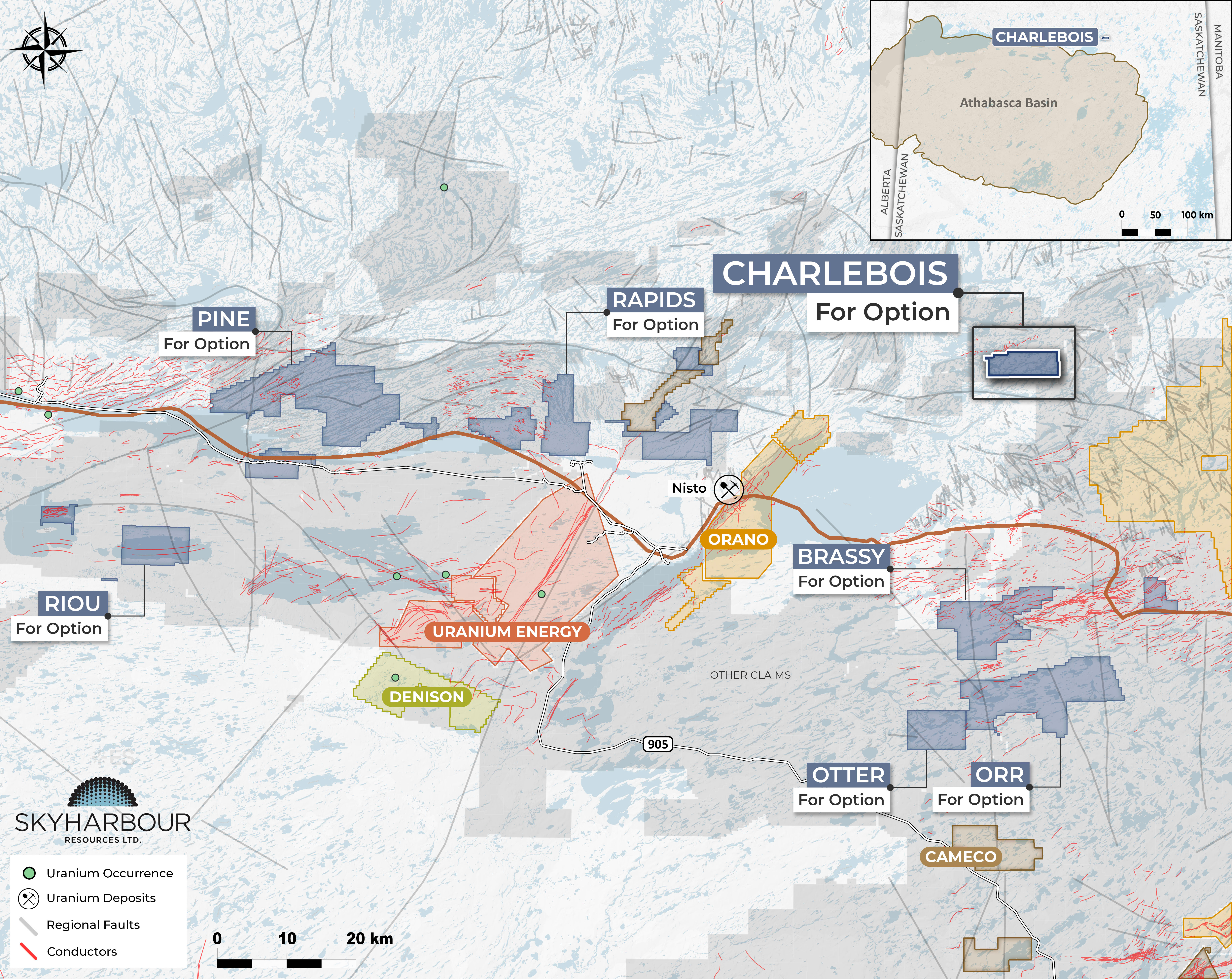
Charlebois
The Charlebois Project consists of one claim totalling 3,583 hectares in the Charlebois Lake area of northern Saskatchewan, staked by Skyharbour in September 2026.
Learn More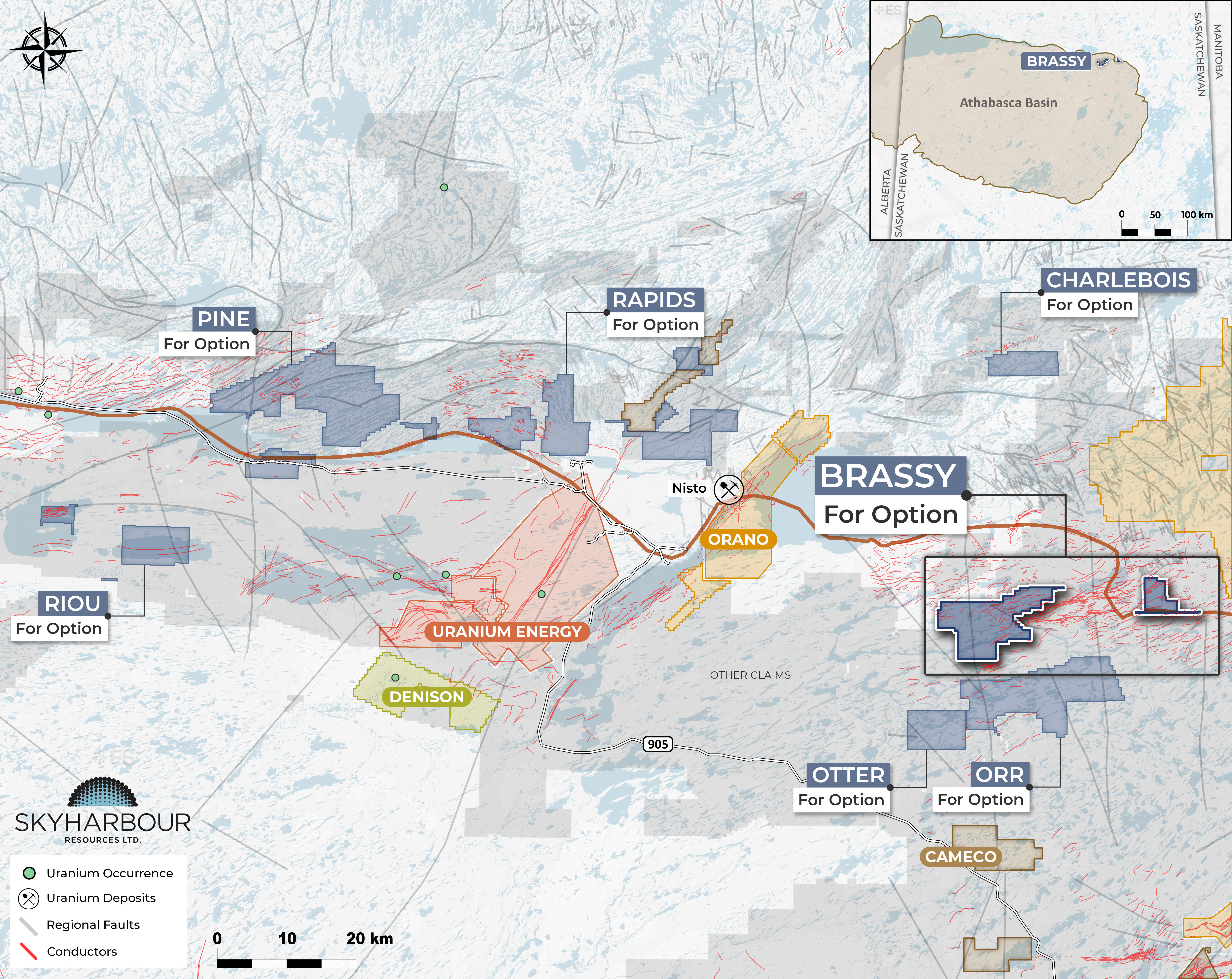
Brassy
The Brassy Project consists of four non-contiguous claims totalling 12,076 hectares in the northern Athabasca Basin.
Learn More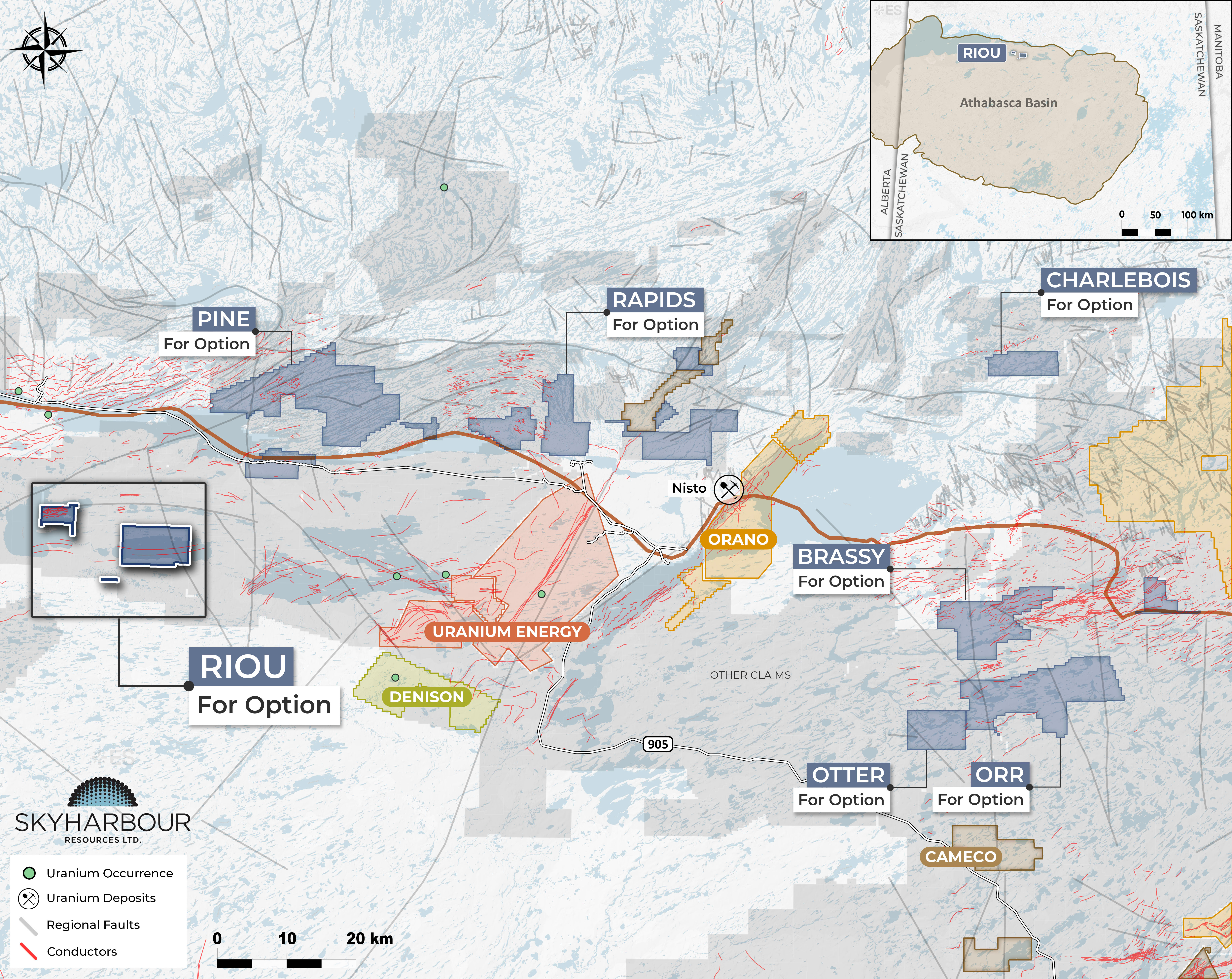
Riou
The Riou Project consists of three non-contiguous claims totalling 6,874 hectares in the north-central portion of the Athabasca Basin, staked in September 2026.
Learn More