

Project Summary
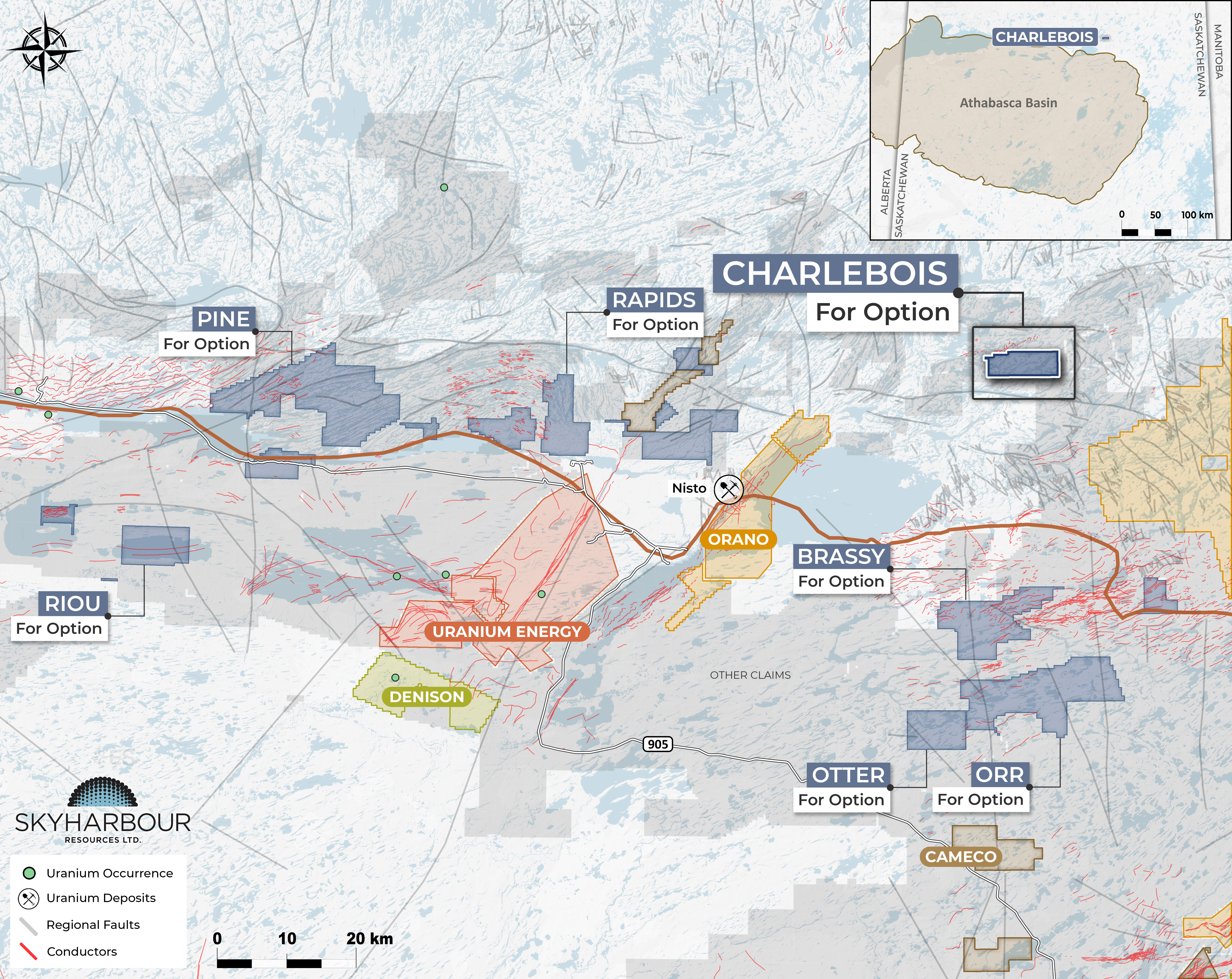
The Charlebois Project consists of one claim totalling 3,583 hectares in the Charlebois Lake area of northern Saskatchewan, staked by Skyharbour in September 2026. The earliest exploration in the area took place in the early 1950’s following the discovery of pegmatite-hosted uranium at Charlebois Lake, consisting mainly of airborne scintillometer surveys, ground scintillometer and magnetic surveys, prospecting, geological mapping, with a number of drill holes drilled just north of the Charlebois project. Additional drilling, airborne radiometrics, and ground radiometric surveys, and ground prospecting followed in the 1960’s to 1970’s. No modern work has been conducted on the Charlebois project, and the project has never had any EM surveys flown.
Historical mapping on the project was limited, with granite being identified as the main rock type underlying the project. However, the regional magnetic intensity and vertical derivative maps show the project is underlain by rocks of a mixed magnetic signature, with a pair of north-west trending moderate magnetic areas wrapping around areas of high magnetic intensity. The moderate magnetic sections connect to the northwest with a northeast-trending moderate-low magnetic intensity area that is host to several pegmatite-hosted uranium showings and mapped as containing metasedimentary and amphibolite gneisses, indicating the potential for similar metasedimentary gneisses to underlie the Charlebois project. The Charlebois Lake area is best known for hosting numerous uranium-bearing pegmatite occurrences, but there is also potential for basement-hosted unconformity-related uranium mineralization as the project only lies about 20 km from the northern edge of the Athabasca Basin.
Contact Nicholas Coltura for more details: ncoltura@sentinelmarket.com